
Walking a Bella Vista Street
A useful Bella Vista street directory separates ownership from residence at every step. The Benton County Assessor ties an address to a parcel and current owner. GIS shows where the lot lies in relation to the road and nearby parcels. The Recorder names buyers and sellers in the deed chain. City permits add dated project and applicant evidence. VoterView verifies one known voter, while a historical cross-reference directory may identify a listed subscriber. None is a full household roster.
- Enter the full address in the Benton County property search. Save the normalized situs spelling, parcel number, owner, mailing address, legal description, and latest deed reference.
- Find that parcel in Benton County GIS. Click the polygon and inspect lot lines, adjacent parcels, roads, address points, and any available aerial or district layer.
- Open each nearby parcel record separately. Sequential house numbers do not prove physical adjacency on Bella Vista’s curved roads.
- Use the deed reference or legal description in the Recorder index. Follow named grantors and grantees while confirming that the same land is involved.
- Add iWorQ permit results, then use VoterView only for a known person with the required identifiers.
- For an older occupant, consult the verified 1996 Polk cross-reference directory and the 1998 regional phone volume.
The flow is address to parcel, parcel to owner, owner to deed, then other dated evidence. That order prevents a map label, mailing address, or applicant name from being treated as a resident list.
Bella Vista Street Property Search
The Benton County Assessor real-estate gateway links to ARCountyData, the first official stop for a Bella Vista address. The parcel card can contain ownership, situs and mailing addresses, legal description, deed transfers, land and building details, current value, assessment history, and homestead status. Search with fewer parts when an exact suffix or normalized street spelling returns no match.
| Assessor field | Input type | Street-directory use | Interpretation |
|---|---|---|---|
| Owner Name | Text | Find parcels tied to a known owner | Try name variants |
| Parcel Number | Exact text | Preserve lot identity | Best continuity key |
| Property Address | Text | Search by number and street | Vary suffix or spelling |
| Legal Description | Result or possible search | Bridge deed and plat | Use subdivision and lot detail |
| City or ZIP | Filter where exposed | Narrow Bella Vista results | Confirm situs versus mailing field |
The captured ARCountyData gateway is the property-search source assigned to the Bella Vista street directory.

A parcel card identifies the assessed owner. It does not list renters, guests, or every person in the home.
Bella Vista Street Address Fields
A street directory result can display two addresses with different roles. The situs address locates the land. The owner mailing address receives tax notices. A mismatch may mean the owner prefers mail elsewhere, but it does not prove that the Bella Vista property is occupied by someone else. Keep both fields, their labels, and the retrieval date.
- Parcel
- A county-mapped land unit with a unique identifier.
- Situs address
- The physical location assigned to the parcel.
- Plat
- A recorded map showing a subdivision, lots, blocks, and easements.
- Criss-cross directory
- A book arranged by address or telephone number, useful for moving from a street to a listed subscriber.
Pair the address with the legal description. That description survives many changes in postal form and is safer than matching a familiar street label alone.
Mapping Bella Vista Street Parcels
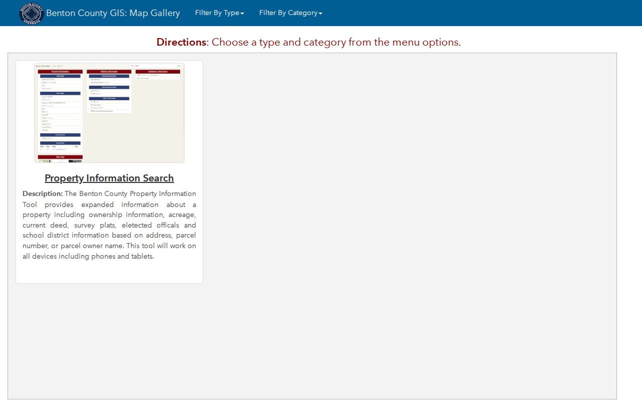
The Benton County GIS Map Gallery supplies the spatial half of a Bella Vista street directory. Locate the target, select its parcel, note the boundary, and pan until lots beside and across the road are visible. Click each polygon and open its official parcel detail. Helpful layers can include parcel boundaries, roads, address points, aerial imagery, jurisdictions, and districts. Layer sets can differ by viewer, so record which map was used.
The successful Benton County GIS gallery capture shows the county’s available map tools.
A map label can lag a transfer. Confirm any displayed name against the linked Assessor record and deed before calling it current.
Note: On Bella Vista’s curving roads, the next house number may not be the next parcel on the ground.
Bella Vista Street Record Sources
The address-keyed sources below answer different questions. Together they can link a Bella Vista street to an assessed owner, parcel shape, recorded transfer, project, or listed subscriber. Access ranges from a free map to a paid record image or an onsite reference request. The proper sequence starts with the parcel because it supplies the legal bridge among sources.
| Record Set | Keeper | What It Shows | Access |
|---|---|---|---|
| Parcel card | Benton County Assessor | Owner, situs, mailing, legal description, transfers | Public web and desk |
| GIS parcel map | Benton County GIS | Lot shape, nearby parcels, roads, aerial context | Free viewer |
| Deeds and plats | Circuit Clerk/Recorder | Buyers, sellers, land identity, subdivision | Index free; images and copies paid |
| Approved permits | Bella Vista Community Development | Applicant, address, work, status, inspections | iWorQ and office request |
| Voter verification | Arkansas SOS | One known voter’s registration geography | Identity fields required |
| 1996 cross-reference | Shiloh Museum | Listed subscriber by address | Onsite or reference inquiry |
The parcel number links the modern property and map layers. The legal description links the parcel to a deed and plat. The street address links permits and the 1996 cross-reference book. VoterView does not support a browse by street, so it belongs only after a known person and required identifying details are available.
Bella Vista Deeds by Street
The Recorder index works best after the Assessor supplies an owner and deed reference. Record the grantee, grantor, date, instrument number, and legal description. A grantor transfers an interest; a grantee receives it. For documents before October 30, 2017, book and page may be needed. Later instruments use numbers beginning with L. Name searches alone can join the wrong person to a similar parcel.
The vendor reports deed indexes from May 3, 1945 and images from January 31, 1933, but the county’s older overview describes reliable web access only to 1990. The safe Bella Vista street directory practice is to label the source and verify early completeness at the Recorder counter. The office at 215 E. Central Ave., Room 202 in Bentonville is open weekdays through lunch, 8:00 a.m. to 4:30 p.m.; recording stops at 4:15.
Index access is free, while pay-as-you-go images cost $0.25 per page. The clerk supplies certified copies. Historical Society deed film and direct or indirect books are the fallback before dependable online coverage.
Bella Vista Permits by Address
The Bella Vista iWorQ portal searches approved permits by permit number, type, property address, or applicant. Results may show status, inspections, and fees paid. The city’s process also accepts online applications and inspection requests. A permit can date new work or an alteration, which is valuable when a parcel card gives only broad building facts.
Applicant is not a synonym for resident or owner. A contractor, business, or representative may file. Match the permit address to the parcel, then use the owner and deed chain for land identity. Permit staff at 479-268-4980 or permits@bellavistaar.gov provide the nonportal channel, and a focused city records request may reach public material not posted online.
Bella Vista Cross-Reference Streets
The strongest verified historical address tool is the 1996 Polk Cross-Reference Directory for Northwest Arkansas held by Shiloh Museum. A criss-cross directory reverses the usual surname order, letting a researcher start with a street and house number. The museum inventory also verifies a 1998 Rogers–Bentonville–Bella Vista telephone directory and a 2000 regional Polk volume. These sources can bridge a modern parcel to a listed household in the planned-community era.
No authoritative open image of a local entry was found. Inspect the title page, abbreviation key, and Bella Vista section onsite before quoting syntax. Unlisted telephone users, seasonal owners, new subdivisions, and other household members may be absent. The historical collections are treated in depth on the Bella Vista city directory, while the street directory uses them only as address evidence.
Bella Vista Address Change Trail
Benton County 9-1-1 Administration provides an unusual continuity clue. When a Bella Vista address changes, the county notifies the Assessor, County Clerk, electric company, owner, post office, telephone company, and responders. Bella Vista changes also go to the Mayor’s office, Architectural Control Committee, Property Owners Association, Bella Vista Post Office, and Water Department.
That broad notice chain shows why one place may appear under different street forms in separate systems. Preserve the parcel number and legal description before searching an older name. Ask the addressing office and permit staff about known variants. Then compare deeds, plats, and older directory entries. Postal changes matter too: a July 2008 realignment moved 2,404 Bella Vista deliveries from ZIP 72714 to 72715, so an older directory may show a ZIP that is no longer current.
Address assignment itself may cover houses, apartments, barns, businesses, mobile homes, sheds, poultry houses, and storage buildings. An address point therefore does not always mark a residence. County 9-1-1 asks about driveway location and the number of structures, then sends the assigned address to postal and emergency services. The street directory should confirm the mapped feature and parcel use before treating any numbered point as a household.
Note: USPS routing, municipal limits, and county parcel geography answer separate questions and should not be merged into one boundary.
Bella Vista Voter Street Limits
VoterView verifies one known voter. Its fields include first name, last name, date of birth, and a county selection, commonly Benton for Bella Vista. A result can show registration status, precinct, polling place, and district information. It cannot be used to scroll through everyone on a street, and it never shows ballot choices. Arkansas does not register voters by political party.
The Secretary of State has a separate written process for statewide voter-file products. Released fields and protected omissions follow the state’s instructions. Even a lawfully obtained file excludes nonvoters and protected participants, so it cannot become a complete Bella Vista street directory. Use this layer for a defined, lawful purpose and retain its date.
Bella Vista Street Directory Limits
No ordinary public record identifies every person at a Bella Vista address. Assessor and deed records focus on ownership. A mailing field may point somewhere else. Permits identify applicants. VoterView omits nonvoters and protected registrants. Regional directories omit unlisted and seasonal households. Utility customer material may be restricted for privacy or security, and motor-vehicle personal information is protected by the federal Driver’s Privacy Protection Act.
Commercial neighbor tools may mix deeds, marketing data, and stale household associations. Treat the category as an unverified lead, not an official block roll. Confirm a current owner with the Assessor and deed. Confirm a past listed subscriber in the dated volume itself. Leave renters and other household members unknown unless a lawful, reliable source identifies them.
Lawful use. Bella Vista address records may be used for personal, lawful research. Never use them to stalk, threaten, intimidate, or harass any person.
A careful street directory records what each source proves and what it cannot prove. That restraint is part of an accurate result.